


Fred la stele

arnoultjf
User
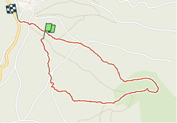

Length
2.5 km

Max alt
1372 m

Uphill gradient
99 m
Km-Effort
3.9 km

Min alt
1245 m

Downhill gradient
128 m
Boucle
No
Creation date :
2019-08-25 07:52:54.946
Updated on :
2019-08-25 12:44:28.435
1h16
Difficulty : Very easy

FREE GPS app for hiking
 SityTrail
IGN / Geographical institutes
SityTrail Plus
The world is yours!
About
Trail Walking of 2.5 km to be discovered at Auvergne-Rhône-Alpes, Puy-de-Dôme, La Tour-d'Auvergne. This trail is proposed by arnoultjf.
Positioning
Country:
France
Region :
Auvergne-Rhône-Alpes
Department/Province :
Puy-de-Dôme
Municipality :
La Tour-d'Auvergne
Location:
Unknown
Start:(Dec)
Start:(UTM)
480230 ; 5044302 (31T) N.
Comments